
มั่นใจ! กล้องและเลนส์ทุกตัว
มีประกันสินค้าในไทย
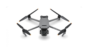
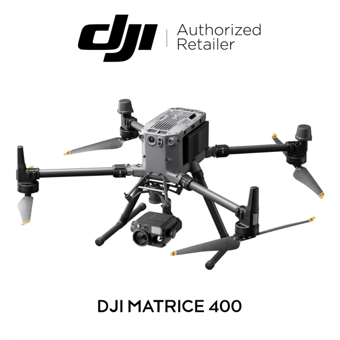
DJI Matrice 400 วิศกรรมขั้นสูงสุด เพื่อการใช้งานไร้ขีดจำกัด
โดรนระดับมืออาชีพรุ่นล่าสุดจาก DJI Enterprise ที่ออกแบบมาเพื่อภารกิจที่ต้องการความแม่นยำ ความปลอดภัย และความอึดขั้นสูง
- เวลาบินที่ยาวนานและประสิทธิภาพความเร็วสูง
- รองรับน้ำหนักบรรทุกได้สูงสุด 6 กิโลกรัม
- การบินที่ปลอดภัยและเชื่อถือได้
- ระบบอัจฉริยะและประสิทธิภาพที่เหนือกว่า
- การทำงานแบบอัตโนมัติ
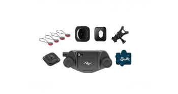
- รองรับอุปกรณ์เสริมครบครัน
- บริการ DJI Care Enterprise เพิ่มความอุ่นใจในการใช้งาน
หากมีข้อสงสัยหรือต้องการสอบถามข้อมูลเพิ่มเติมเกี่ยวกับสินค้า สามารถติดต่อเราได้ผ่านช่องทางแชท ได้ที่ m.me/BIGCAMERACLUB
ราคา
฿0 บาท

Long-Endurance Drone Platform With Power-Line-Level Obstacle Sensing
DJI Matrice 400
Engineered for Excellence, Designed for Versatility
DJI Matrice 400, the enterprise flagship drone platform, boasts an impressive 59-minute flight time, a payload capacity of up to 6 kg, and integrated rotating LiDAR and mmWave radar for power-line-level obstacle sensing. It also supports the O4 Enterprise Enhanced Video Transmission and Airborne Relay Video Transmission, ensuring safer handling and easier operations. Combining Smart Detection with visible and thermal imaging, AR projection, ship-based takeoff/landing, and advanced automation, Matrice 400 excels in emergency response, power inspections, mapping, and AEC.

Welcome to DJI Support
เช็ครุ่นสินค้าที่เข้ากันได้ที่นี่
Extended Flight Time, High Speed Performance
Matrice 400's flight capabilities are outstanding, offering up to 59 minutes of forward flight time even with a payload, and up to 53 minutes of hovering duration. These capabilities make it a reliable tool for long-duration and continuous operations such as search and rescue, firefighting, and large-scale mapping. It can also avoid large obstacles like buildings and mountains at flight speeds of up to 25 m/s.
Up to 59 Mins
Forward Flight Time
Up to 25 m/s
Flight Speed
Multi-Payload, Multi-Scene
Matrice 400’s strong payload capacity allows it to easily meet the demands of a wide range of applications. With a maximum payload capacity of 6 kg, Matrice 400 supports seamless switching between a single downward gimbal and a dual downward gimbal. It also features a third gimbal connector on the underside for additional flexibility. The aircraft is equipped with 4 external E-Port V2 ports, enabling simultaneous mounting of up to 7 payloads.

Depending on the task, Matrice 400 can be equipped with the Zenmuse H30 Series, L2, P1, S1 Spotlight, V1 Speaker, Manifold 3, or third-party payloads, thereby expanding its capabilities and unlocking the full potential of the DJI ecosystem.

Zenmuse H30 Series
The Zenmuse H30 Series integrates five major modules—a wide-angle camera, a zoom camera, an infrared thermal camera, a laser range finder, and an NIR auxiliary light. Employing cutting-edge intelligent algorithms, it revolutionizes perception and imaging standards, transcending the limitations of day and night vision.

Zenmuse L2
Zenmuse L2 integrates frame-based LiDAR, a self-developed high-accuracy IMU system, and a 4/3 CMOS RGB mapping camera, providing DJI multi-payload drone platform with more precise, efficient, and reliable geospatial data acquisition.

Zenmuse P1
Zenmuse P1 integrates a full-frame sensor with interchangeable fixed-focus lenses on a 3-axis stabilized gimbal. Designed for photogrammetry flight missions, it takes efficiency and accuracy to a whole new level.

Zenmuse S1
Zenmuse S1 is DJI's first spotlight designed for multi-payload drone platforms. Utilizing the LEP technology, it offers high brightness and long illumination distance, and supports multiple lighting modes. This makes it ideal for public safety, emergency rescue, inspection, and other nighttime operations.

Zenmuse V1
Zenmuse V1 is DJI's first loudspeaker designed for multi-payload drone platforms. It boasts high volume and long broadcast distance, and supports multiple broadcast modes, making it ideal for scenarios like public safety, emergency rescue, and more.

Manifold 3
Manifold 3 packs an impressive 100 TOPS of computing power into a compact unit weighing about 120 g. It can be mounted onto Matrice 400 drone platform, optimizing efficiency across various operational missions with its robust processing.
Flight Time
Estimate the Matrice 400’s flight time based on payload configuration.

Safe and Reliable Flight
Built for Challenging Conditions
Matrice 400 has a protection rating of IP55, allowing it to operate reliably in challenging conditions including heavy dust or rain. It also maintains stable performance across temperatures from -20° to 50° C (-4° to 122° F), delivering consistent results in both hot and cold conditions.
IP55
IP Rating
-20° to 50° C (-4° to 122° F)
Operating Temperature
Power-Line-Level Obstacle Sensing
The Matrice 400's advanced obstacle sensing system integrates rotating LiDAR, high-precision mmWave radar, and full-color low-light fisheye vision sensors, pushing detection capabilities to unprecedented levels. The system detects even small obstacles like high-voltage power lines across mountainous terrain — even in darkness. It can penetrate rain and fog to sense its surroundings, providing enhanced safety in challenging weather conditions.
Robust Video Transmission
O4 Enterprise Enhanced Video Transmission System
Thanks to the ten-antenna system on the aircraft and the high-gain phased array antenna system on the remote controller, the O4 Enterprise Enhanced Video Transmission System can achieve image transmission up to 40 km.
Matrice 400 also supports the sub2G frequency band, and when equipped with two DJI Cellular Dongle 2, it can automatically switch to the better available carrier network, providing a more stable signal even in urban interference environments or remote regions.
Airborne Relay Video Transmission
Matrice 400 has a built-in video transmission relay module. With this setup, one Matrice 400 can serve as a relay drone, flying high to provide relay signals for another Matrice 400 operating at a greater distance. This capability significantly extends the transmission range, making it ideal for search and rescue tasks as well as inspections in mountainous areas.
Aircraft Fusion Positioning
The omnidirectional sensing performance brought by rotating LiDAR, high-precision mmWave radar, and full-color low-light fisheye vision sensors provides Matrice 400 with strong positioning capabilities. It can fly stably close to glass-facade buildings or wind turbine blades and safely return from building edges, mountain bases, or bridge sides even when the return point has not been updated.
Full-Color Vision Assist
The four full-color low-light fisheye vision sensors on the aircraft provide Full-Color Vision Assist to ensure safer flight.
Enhanced Intelligence and Efficiency
Smart Detection
With Zenmuse H30 Series' visible and thermal imaging, Matrice 400 can detect vehicles, vessels, and subjects during search and rescue operations or routine flights. It also supports switching to other models, enabling the expansion of application scenarios. Additionally, it supports high-res grid photos and features powerful tracking capabilities.
Smart AR Projection
Power Line AR
During tasks such as power grid inspection, the obstacle sensing system automatically detects frontal wire obstacles and displays easily recognizable AR lines on the remote controller’s screen, making the surrounding environment clear at a glance and ensuring safer flight.
Map View AR
When operating during the day or night in urban regions, the remote controller can display the names of buildings and landmarks in real-time, marking core roads with prominent lines.
AR Flight Waypoint
Real-time route preview is available for the drone during RTH, obstacle sensing, and FlyTo operations. During landing, the AR Aircraft Shadow can be displayed to help operators confirm the landing location.
Live Annotations
Without modeling, you can mark points on the remote controller screen to obtain subject locations, draw lines to measure distances between multiple points, and outline areas to calculate their size. Measurement results can be synchronized to the DJI FlightHub 2 to enhance team efficiency.
Real-Time Terrain Follow
Matrice 400 supports Real-Time Terrain Follow flight in any horizontal direction. This feature can be enabled during both manual flight and automated flight routes, ensuring stable relative height to the ground.
During large-scale search and rescue operations, the size of ground subjects can be kept consistent on the remote controller screen, reducing the need for frequent zoom adjustments and improving efficiency. During mapping missions, a consistent ground sampling distance (GSD) can be maintained to obtain high-precision mapping data.
Takeoff and Landing on Ships
To address the needs of offshore operations such as maritime patrol and wind turbine inspection, Matrice 400 is equipped with the capability to take off from and land on ships, supporting takeoff from stationary vessels and landing on moving vessels. By detecting landing point patterns on the deck, it can achieve safe and precise landings.
Intelligent Flight Modes
Cruise
Activate cruise control mode to pilot the drone in a specific direction without constantly pressing the control sticks, making long-distance flights or linear inspections easier.
FlyTo
In emergencies or disasters, the drone can automatically adjust its flight path and speed based on the surrounding environment, allowing it to reach a designated location without manual adjustments.
Smart Track
Smart Track allows for precise subject positioning and automatic zoom adjustments, allowing you to switch between subjects easily. It can automatically reacquire a subject even if obscured briefly.
POI
POI enables continuous observation and 3D modeling of buildings while orbiting a designated area, greatly enhancing the efficiency of fixed-point observation and modeling tasks.
Easier Automated Operations
Power Line Follow With Zenmuse L2
When equipped with the L2 LiDAR system, Matrice 400 can perform automated power transmission and distribution line following flights. It uses the rotating LiDAR to detect obstacles in real time and automatically bypasses crossing lines.
Slope Route & Geometric Route
Matrice 400 supports the planning and execution of slope and geometric routes via DJI Pilot 2 or DJI FlightHub 2. Whether conducting detailed aerial surveys of building facades, slopes, or other inclined surfaces, or collecting mapping data of individual buildings or structures, Matrice 400 can quickly plan slope or geometric routes to efficiently acquire high-precision data.
| Color | Cream |
|---|
Write Your Own Review


สินค้าแนะนำ
![EZVIZ C3TN OUTPRO 3MP WI-FI CAMERA H.265[EZV-C3TN-A01H3WKFL]](https://www.bigcamera.co.th/media/catalog/product/cache/a27455155b8532b3489e52a078cf4119/e/z/ezviz-c3tn-outpro_1__1.jpg)
![OM SYSTEM BODY CAP LENS 15MM. F8 [BCL-1580]](https://www.bigcamera.co.th/media/catalog/product/cache/a27455155b8532b3489e52a078cf4119/o/l/olympus_body_cap_lens_15mm._f8_bcl-1580__1.png)